
The Pennypack Preserve trails are open to the public 7 days a week from 8 a.m. to dusk. Feel free to drop by the office Monday – Friday from 9 a.m. to 5 p.m. or the Visitors’ Center on Saturdays from 10 a.m. to 2 p.m. and Sundays from 11:00 AM to 2:00 PM to find out more about our trails.
8.5” x 11” printable version
11” x 17” printable version
Hiking Only Trails
Foot traffic only; No Pets. No Bikes.
Beech Springs Trail (0.6 mi.)
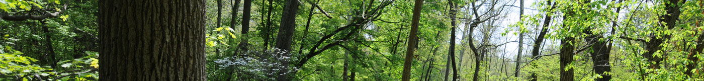
Trail features incredible diversity over a short distance including beautiful meadows, a majestic old forest, spring seeps, and panoramic views.
Bethayres Woods Trail (0.9 mi. loop)
Dirt footpath. Wetlands near trailhead, mature woodlands and Pennypack Creek overlook in the upper loop. Note: Bethayres Woods is not contiguous with the remainder of the preserve.
Management Trail (0.2 mi.)
Mowed grass and dirt footpath alongside floodplain forest and meadows.
Management Trail Spur (0.05 mi.)
Short mowed grass footpath linking Creek Road and Management Trails.
Meadow Crossing (0.2 mi.)
Panoramic introduction to Raytharn Farm on a wide grassy footpath.
Mitchell Trail (0.4 mi.)
Trail begins at the intersection of Huntingdon and Edge Hill Roads on a gentle slope in mature woodland, then descends quickly over a rocky outcrop into the valley.
Overlook Loop Trail (0.2 mi.)
Woodland footpath offering panoramic view of the Pennypack Creek valley in winter from a rocky knob. Forest restoration in progress.
Paper Mill Road Trail (0.4 mi.)
Dirt footpath following old roadbed; western half very steep and rocky. Scenic crossing of Pennypack Creek over third-oldest bridge in Montgomery County, built in 1817.
Paper Mill Woods Trail (0.74 mi.)
Trail winds through open meadows and young woodlands as it encircles the headwaters of the cleanest stream in the preserve.
Pennypack Trust Headquarters Trail Network (1.0 mi., total)
Wood chips, mowed grass. A series of short, interconnected footpaths through the Trust’s 25-acre headquarters. Approximately half of the property is wooded, half meadow. Features a visitor center, restrooms, pond, springhouse, picnic area, and bird blind.
Peak Trail (0.2 mi.)
Dirt footpath, rocky near the crest. Trail skirts a rocky knob (“The Peak”), and then winds through one of the preserve’s finest old growth forests.
Raytharn Trail (1.3 mi.)
Mowed grass. Spectacular sweeping views of the region’s topography and the Bryn Athyn Cathedral. Native grassland establishment in progress.
Rosebush Trail (0.2 mi.)
Steep, rocky woodland footpath leading downhill to a 23-year-old restored forest..
Webb Walk (0.3 mi.)
Level dirt footpath, some sections of which are uneven and muddy. Impressive display of naturalized spring flowers and an 18th century springhouse hugging the west bank of Pennypack Creek. Note: The Trust no longer maintains the southern section of the trail south (downstream) of the springhouse because repeated flooding has damaged the trail surface making walking very challenging.
Multiple Use Trails
Hiking, biking, horses, pets on leashes; No motorized vehicles
Creek Trail (1.4 mi.)
Wide, graveled trail through floodplain forest with views of Pennypack Creek, Crossroads Marsh, forest restoration and several sites of historic significance.
Pennypack Creek Trail (0.6 mi.)
Level dirt footpath; may be muddy in the winter and following rains. Floodplain forest and conifer plantations.
Pennypack Parkway (0.6 mi.)
Compacted stone screenings over old roadbed. Floodplain and upland forest, creek view, and ruins of colonial Mason’s Mill dam.
8.5” x 11” printable version
11” x 17” printable version
Pennypack Trail (Montgomery County)
Pennypack Trail (Entire length: 5.0 mi.; Within Pennypack Preserve: 2.5 mi.)
Montgomery County’s Pennypack Trail bisects the Pennypack Preserve and provides opportunities to create several loop hikes incorporating the Pennypack Preserve trails. Montgomery County’s Pennypack Trail, built on the unused Fox Chase-Newtown railroad bed, is level and surfaced with compacted limestone grit. Hikers, bicyclists, and equestrians are welcome on the trail, as are dogs on leashes. South of the Pennypack Preserve, the trail continues to Montgomery County’s Lorimer Park and on into Rockledge Borough.